Section 1: Lower City – From the Establishment of the Port City, Looking Towards the Future | 3.75 Km
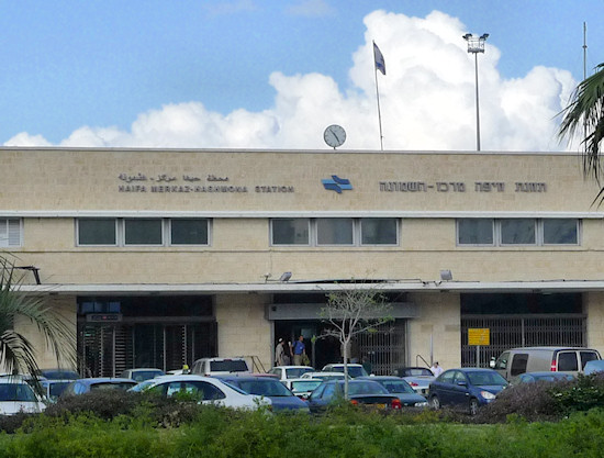
Starting point: Ha’azmaut Rd. – Haifa Center HaShmona Railway Station | 5m above sea level
Ending Point: Hassan Shukri St. – Memorial Park | 165m above sea level
The first section of the trail begins in the Lower City, where Haifa developed. It grew during the Ottoman period and gradually became an important commercial center. The Lower City developed significantly and flourished during the British Mandate when the British transformed Haifa into their most important industrial, commercial and transportation center in the Middle East. On the eve of the establishment of the State of Israel, the Lower City was the economic commercial hub of the "yishuv" (pre-State Israel).
From the railway station plaza, cross Ha’azmaut Rd. and turn right. On the left is an office block and further on, the Greek Orthodox cemetery. Walk the length of the cemetery wall and at the end turn left down a narrow alleyway that leads to Jaffa Rd., once the main artery from Haifa south and distinguished by many buildings constructed in the local Arab style. Turn left on Jaffa Rd. and continue in a south-easterly direction. Turn right into Pikadon St. The names of the streets in this area, which is near Ha’bankim ("The Banks") St., are mainly derived from the banking world. Turn left into Sara St. It was named after Amin Sara, a local landowner upon whose land the “New Commercial Center” was constructed in the 1930s; cross the center to reach Ha’bankim St. Turn left on Ha’bankim St. and then right onto the continuation of Jaffa Rd.
Opposite the Port Inn hostel are some of the most beautiful residential buildings in the street, constructed in the “Liwan House” Arab architectural style. Between numbers 24 and 26 on Jaffa St., enter a hidden alleyway that leads into the Khayat compound, an impressive complex of buildings constructed around an inner courtyard that was built by the family of Aziz Khayat. In the past the complex housed government offices; since their relocation, the buildings remain empty and await restoration to their former glory.
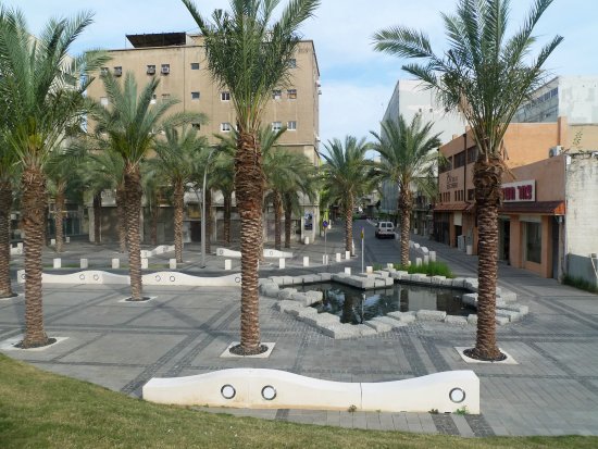
Exit onto Ha’atzmaut St. Note the plaque on the façade of the building on the right – 82 Ha’atzmaut Street – commemorating the Zionist paramilitary group “Irgun”’s attack on the British military headquarters that was housed in the building. Ha’atzmaut St., once “Kings Highway”, was constructed by the British in an area that was reclaimed from the sea during the construction of the port. Notice the buildings on the north-eastern side of the street that create a long, continuous façade. They were designed by the British architect and town planner Albert Clifford Holliday. Cross Ha’atzmaut. St. into Sha’ar Palmer (“Palmer Gate”) St. Opposite is the Haifa Port fence. Originally, the port’s main entrance was situated at the end of this street. Sha’ar Palmer St. is intersected by Hanamal St. This area is undergoing urban renewal and development as an academic campus comprising extension of the University of Haifa, Tiltan College of Design and the Carmel Academic Center. Turn right into Hanamal St. and walk until you reach a grassy area and a fountain, one of the few green spots in the Lower City. Turn right and enter a passage that runs underneath the long building back to Ha’atzmaut Rd.
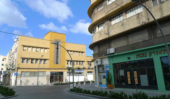
Cross the road on the pedestrian crossing onto the south-western side. Opposite is a complex of uniform buildings distinguished by balconies and situated among narrow streets with no access to motorized vehicles. Turn right on Ha’atzmaut Rd. and left into Moshe Aharon St. This is the heart of the “Old Commercial Center”, a complex of buildings constructed in a uniform style in the 1920s above a floor of market stores designed by the architect Fritz Kornberg. Over the years, the area became known as the “Turkish Market”, a name that has been adopted now as part of the renewal process the area has undergone. Turn right on Kehilat Saloniki St. and left into Natan St. that leads to Natanzon Street (the continuation of Jaffa St.). On the right in Natanzon Street stands the impressive edifice of the former Anglo-Palestine Bank designed by the architect Alexander Baerwald who left his stamp on several important buildings throughout the city. The upper wing of the building is of a later date and was designed by Yohanan Ratner.
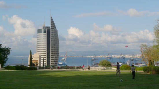
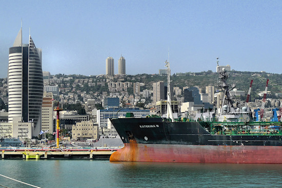
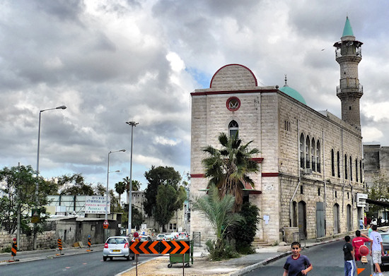
From Natan St., turn left into Natanzon St. and continue on to Kikar Hamra (Hamra Square), known today as Kikar Paris (Paris Square) as a tribute to the French company that constructed the Carmelit, Haifa’s subway, whose final stop in the Lower City is situated here. The area around the square was once the heart of Haifa’s Christian quarter and contains several churches, including the Carmelite Church. The square bordered what used to be the Muslim city of Haifa, which was enclosed by a wall that ran as far as the end of the square. Continue from the square on Natanzon St. and imagine crossing the wall and entering the Muslim city. It was known as “Haifa Al-Jadida” – new Haifa – to distinguish it from “Haifa Al-Atika” – old Haifa – the even older city that is actually located a few kilometers to the west. Most of the typical buildings here were destroyed in 1948 and were replaced by contemporary buildings with large spaces between them, such as the parking lot along which the route passes. Pass by the Al-Jarina Mosque with its impressive clock tower. This was Haifa’s main mosque during the Ottoman period. In the background is the modern tower housing government offices known as the “Missile” or the “Sail”. Continue under the government office compound passing another mosque - the small mosque. Due to the directive prohibiting the destruction of religious buildings, the mosques became a reminder of the buildings that once stood here.
Turn right and join Pal-Yam Blvd. Opposite are the city’s new law courts. Cross Pal-Yam Blvd. and turn left. On the right are the remains of buildings constructed in the Arab style. Turn immediately right into the narrow Al-Buhturi St. and immediately left into Hammam al-Pasha St. On the left is the dome of the hammam, the bath house, of Khalil Pasha, the city’s mayor at the end of the nineteenth century. Continue on Hammam al-Pasha St. to Shivat Zion St. On the left is the Istiqlal Mosque, the largest mosque in the city. Continue down to reach the continuation of Pal-Yam Blvd., passing the memorial column to the Iraqi King Faisal. The column commemorates the transfer of his body from Europe via Haifa for burial in Iraq. Continue on to the traffic lights and turn left into Hakatar (“The Locomotive”) St. Opposite is the Haifa East railway station, an important international stop during the Ottoman and British Mandate periods. To cross to the other side, continue right on Hativat Golani St. and carefully cross the road opposite 16 Hativat Golani St. Beside the railway station, note the Monument to the Hejaz Railway and visit the Railway Museum.
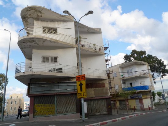
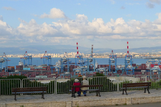
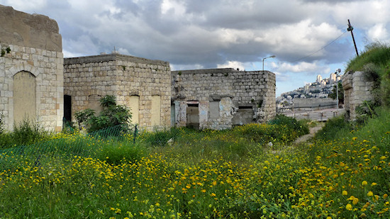
Return to HaKatar St. and walk up as far as Kibbutz Galuyot St. On the corner is the old Hadar cinema. Cross Kibbutz Galuyot St. and glance into the shop at number 42 where there is an interesting mural. Continue along Kibbutz Galuyot St. arriving at a roundabout. Opposite, the road forks; take the street on the right – a continuation of Kibbutz Galuyot St. – that leads to Haifa’s “flea market”. At the weekend, the area is teeming with hawkers and bargain hunters. Turn left into narrow Omar al-Hattab St. and immediately right into Wadi Salib St. On the left are the magnificent, abandoned buildings of the Wadi Salib neighborhood that were constructed around the wadi. The street merges into Shivat Zion St., continue on Shivat Zion St. The dome of the hammam and the law courts are once again visible. The architecture of the law courts contrasts sharply with the fine stone buildings that surround it. On the left is an arched gate, go through the gate to reach a flight of steps – the Eglon Steps – and climb up through the Wadi Salib neighborhood emerging onto Ma’ale Hashichrur St. and continue up in the direction of Hassan Shukri St. where, beside the Haifa Municipality compound, is a memorial garden dedicated to the residents of Haifa who were killed in the War of Independence. From here, there is a beautiful view of the Lower City and the sites passed on this section of the trail.
English translation by Roberta Neiger sponsored by the social hub for community & housing, Faculty of Architecture and Town Planning, The Technion
