Section 6: Nave Sha’anan – The Beginning of Mountaineous Jewish Haifa | 4 Km
Starting point: Corner of Berl St. and Pinhas Re'em St. Ziv Neighborhood | 198m above sea level
Ending point: Mallal St., The Technion Entrance | 212m above sea level
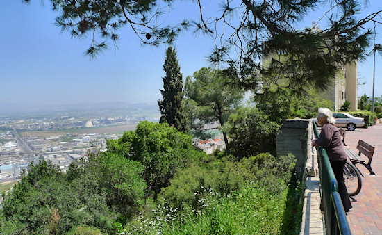
This section focuses on Nave Sha’anan. Before arriving at the center of the neighborhood, we shall take in the view from one of the most pleasant gardens in Haifa: “Hurshat Hameyasdim” (Founders Grove).
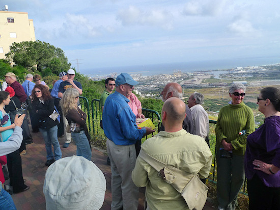
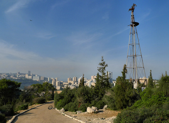
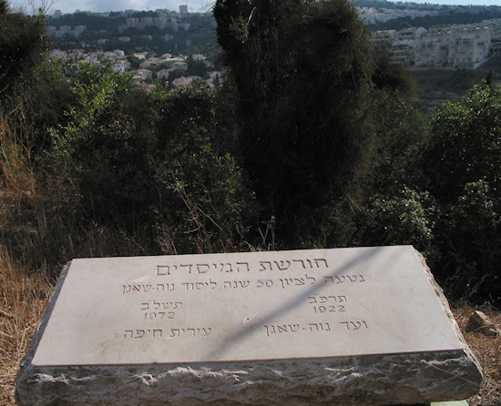
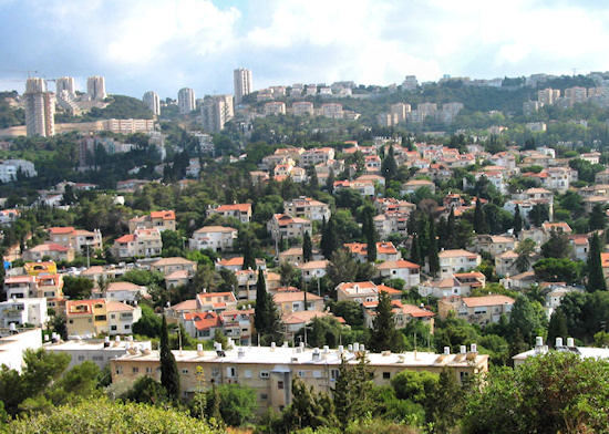
The section starts at a roundabout that connects Pinhas Re’em St. to Berl St. Continue up beyond the roundabout to Mandele Moher Sefarim st. Continue up the slope straight ahead, following the unpaved road, as far as Ruth HaCohen St. Look left (west) where a pleasant hill beckons. Walk up to join the perimeter path that winds around the hill. Turn left and walk around the southern flank with the path inclining right. At a certain point the path forks. Turn right to the top of the hill arriving at Gan Hameyasdim (Founders Garden) named in memory of Nave Sha’anan’s founders. The grove was planted in 1972 to commemorate fifty years since the neighborhood’s establishment. At the top of the hill stands a strange, rusty column, which lent it the nickname “Givat Ha’Shavshevet” or “Wind Wheel Hill,” after the wind wheel that once stood at the top of the column and that activated a water pump. From the top of the hill is an interesting view of the neighborhoods on the north-eastern slopes of the Haifa Carmel ridge.
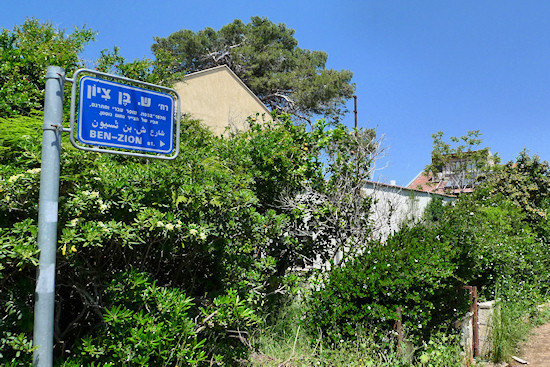
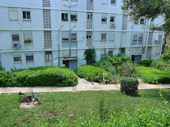
Walk back down the hill and at the intersection of the first path turn right in a downward direction. At the next left junction with the path that leads back to Mandele Moher Sefarim, bear north. Turn right into Sheleg St. (Shmuel Leib Gordon), then right into Ben-Zion Blvd., left into Genessin St., and left into Frug St. This tiny maze of streets leads through a particularly interesting complex of buildings made up of two-floored homes that are reminiscent of residential kibbutz buildings and were constructed as workers’ residences.
From Frug St. enter Berl St., turn right and then left into Fayerberg St., which leads to Hanita St., after the settlement of the same name. Hanita St. leads into old Nave Sha’anan. From this point, and for approximately a kilometer, there is a break from the ups and downs: Nave Sha’anan is built upon a “platter” at 200 meters above sea level. At the time of its establishment, when the Carmel was completely free of concrete, the area was considered a mountainous holiday destination in contrast to the lower reaches of Hadar Hacarmel that were closer to the sea. The neighborhood was designed by Richard Kauffmann and its foundation constructed along three longitudinal main streets – Hanita St., Galil St. and, between them, the appropriately-named Tichon (“Middle”) St.
From Feyerberg St., turn left into Hanita St. and cross the road at the junction with Simcha Golan Rd. Enter Landau Walk that leads to Shaul St. Turn left on Shaul St. and right into Habrekha St. Glance down Habrekha (“Water Reservoir”) St. – opposite is the water tower after which the street is named, which will be mentioned later. On the corner of Habrekha St. and Tichon St., note 60 Tichon St. This is what remains of the modest houses that were constructed for Electricity Corporation employees in the neighborhood’s early days.
From Habrekha St. turn left into Tichon St. Public buildings, such as the Rambam Synagogue constructed in 1936, are located at number 39. At number 28 stands another building that housed Electricity Corporation employees.
At the end of Tichon St. is the Gan Habanim Memorial Garden with its monument commemorating Nave Sha’anan residents killed in Israel’s wars.
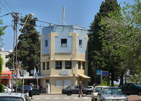
Turn right into Habanim St. and right again into Galil St. Several of the neighborhood’s original buildings are preserved, such as Ben-Zvi House at 28 Habanim St., which was constructed in 1923, 41a Galil St., and the water tower. The water tower was constructed in 1925 and spared the residents the effort of conveying water on donkeys to the neighborhood on the ridge.
From the water tower continue the length of Galil St. taking note of number 97, Beit Wishnitzky, which was constructed in 1922 by Ya’acov Wishnitzky, one of the neighborhood’s founders. At number 99 is the “Cinema Café Amami”, which began operating in the 1940s as a Workers’ House, and is now one of the last remaining neighborhood cinemas in Haifa.
Number 197 houses the Tel-Hai School, which was established in 1922; during the period of conflict with the British Mandatory authorities, weapons were concealed in a secret hiding place ("slick" in Hebrew) in one of the classrooms. Today, the school hosts the “Slick Museum”, which provides a local perspective of the neighborhood’s history of armed conflict.
Continue south-east on Galil St. After passing number 119, the view opens up to the east and north. This is one of the more interesting observation points to view the industrial area of Haifa Bay. The oil refineries and the chemical industry they nurture are the closest factories. At night, the kaleidoscope of color they project provides another interpretation of “Haifa’s Sea of Light,” prophesied by Theodor Herzl in Altneuland. This industry was developed during the British Mandate at a time when the British were attempting to turn Haifa into the Middle Eastern capital of their empire. Oil flowed here through pipes from Iraqi oil wells for refinement in the refineries and the products, together with crude oil, were exported through the port. It is said that in the past the homes of Nave Sha’anan residents were frequently coated in a film of black dust. Since then, the polluted emissions have been significantly reduced in the Haifa Bay area, but the odors that usually prevail in the lower reaches of the bay testify that there is still room for improvement.
From here enter the path between 114 and 116 Galil St., which leads to the other side of the Nave Sha’anan ridge. On Harav Maimon St. turn right in a westerly direction. On Gilboa St. turn left, and continue in a general south-westerly direction. Cross busy Shalom Aleichem St. at the pedestrian crossing and continue up Gilboa St. Turn left into Harav Kalisher St. as far as Adam HaCohen St. Turn right on Adam HaCohen St. and continue up as far as Mallal St. On Mallal St. turn left to reach the Technion entrance and the next stage of the trail.
English translation by Roberta Neiger sponsored by the social hub for community & housing, Faculty of Architecture and Town Planning, The Technion
