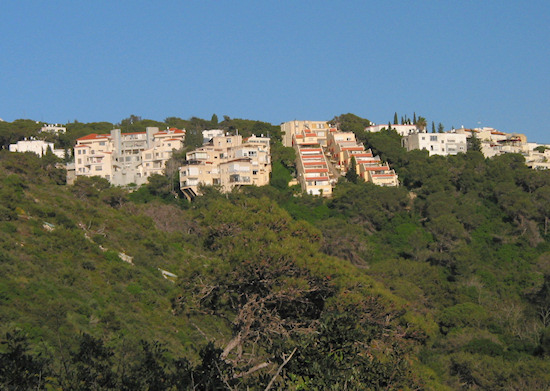
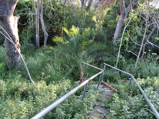
Section 11: Wadi Ahuza and center of the Ahuza neighborhood | 3 Km
Starting point: Horev St., corner of Freud St. | 280m above sea level
Ending point: Moriah Blvd., corner of Kiryat Sefer, David HaCohen circle | 285m above sea level
This section is devoted to the history of the Ahuza neighborhood. The route starts with a nature walk through Wadi Ahuza, which played a major role in the original settlement of this neighborhood, and continues through its earliest streets.
Begin at the junction of Horev St. and Freud St., and take a short stroll down Freud to the corner of Vitkin St.
Those interested in skipping the nature walk through the wadi should continue on Vitkin St., and connect to the continuation of Section 11 on Vitkin St. at the corner of Lahish.
To walk through Wadi Ahuza, make sure you have comfortable shoes, water and sunscreen, if the weather is hot.
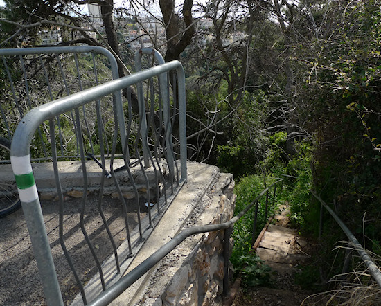
Next to Freud, corner of Vitkin, is a stairway and white-green-white trail blazes provided by the Society for the Protection of Nature in Israel. The blazes mark the Wadi Ahuza route. Go down the steps and soon you will forget how close you are to the bustling city center. Pass through typical Mediterranean flora as you descend the wadi. Two springs originate along the trail: the Fig Spring (Ein Te’ena), which starts in a small pool suitable for bathing, and further on, the Ahuza Spring. As you walk, you will pass an old pump house, which was part of the water system that supplied water to the residents of the young Ahuza neighborhood. The wadi continues westward to the sea, but the main road, Freud St., blocks its passage and the trail cuts north up the wadi’s bank.
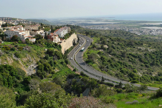
Striking views of the sea open up to the south, as you climb back to “the city”.
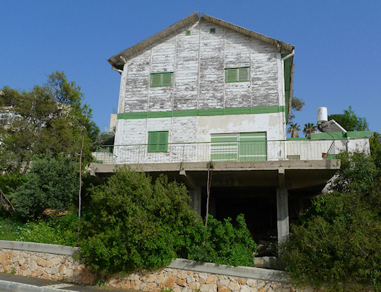
The path leads you to a traffic circle from which you start to go up Schecter St. On the right is a contemporary-looking house that incorporates elements of steel. Afterwards, on the right is house with wooden walls that appears unconnected to this place. Opposite you see the terraced structures so typical of construction on the city’s slopes, in this case, a northern tributary of wadi Ahuza. After the wooden house, turn right to a narrow paved road – you are now going behind the houses you passed earlier. The road runs into a path and turns left to Lahish St., which you follow to the meeting point of Vitkin St., one of the most pleasant streets in the Carmel.
As you arrive from Lahish to Vitkin pay attention to the structure at Vitkin 9, which is nicknamed “The Boat house”. Also take a peek at the building next door, at Vitkin 11. If the glass-and-metal style appears familiar, it is due to the architect, Theodor Menkes, who planned the ‘Glass House’ we visited in Section 3. When your back is to Lahish St., turn left on Vitkin and continue to Smolenskin St. On Smolenskin turn left and continue to the Carmel Medical Center.
No medical emergency: just an opportunity to learn a little about the hospital’s structure and view several nearby buildings. The medical center, designed by Architect Yaakov Rechter, was built in 1976 on the ruins of the Borochov convalescent home despite opposition from residents in the quiet neighborhood.
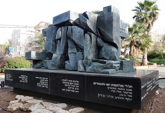
Circle the large building on Tel Maneh St. as you enjoy views of the sea to the south. The street curves right. On your left, on Tel Maneh 20 is one of Haifa’s copper houses (we will see another in Section 20). On Tel Maneh 9 behind a gate is an interesting structure designed by Shraga Friedrich Rohatyn, a Haifa architect who planned a number of buildings on the Carmel. This building served as the home for the elderly, Beit Yules, and is today part of the Carmel Medical Center complex. The continuation of Tel Maneh St. brings you to a small traffic circle with a monument to the young men of Ahuza who fell in Israel’s wars.
Continue upward on Mapu St. On Mapu 5 you see sheltered housing “Michal”, which was designed by Architect Gideon Kaminka who also planned the Clock House in Hadar.
On the upper part of Mapu St., the road forks. Turn right. On your left is a garden, Gan Glicker, previously called ‘Gan Itzhak’. This garden was named for Itzhak Glicker, known as "the first sick fund doctor in Haifa”. It was already in existence during the earliest years of Ahuza, whose streets you will shortly enter.
Before that, look right to the building on Horev 2. This is one of the first structures on the Carmel. It was designed by Moshe Gerstel, who designed the Talpiot market in a distinctly international style. Note the stairway with its glass windows. The structure was erected in 1935. It was intended for use as a hotel but was used to house new immigrants and later, as a hospital. Here stood the Carmel Medical Center before the large new structure was built in the 1970’s. Today several of its units remain.
Before continuing, take a peek at Horev 4, a product of the 1930’s international style, designed by architects Oral and Zohar. For 70 years straight, until 2007, the ‘Ahuza Pharmacy’ was run here by the Lerner family.
It is hard to believe that this area was once an agricultural settlement. The “Ahuza Association”, founded in 1921 in Bucharest, Romania, by four Zionist Jews aimed at enabling Jews from Romania to purchase Carmel lands, thus laying the foundation for settlement here. The neighborhood is named for the first Jewish British High Commissioner of Palestine, “Ahuzat Herbert Samuel”, in short “Ahuza”. The first settlers arrived to the place in 1925, and Horev St., where you are now standing, was paved in 1935. In this area, impressive buildings were erected, especially in the international style. The transformation of this area to a commercial hub resulted in new facades for some buildings and led to the destruction of many other buildings.
Cross Horev St. opposite Gan Glicker. Go a little ways up the street and turn right onto Sinai St. This is one of the oldest streets in the neighborhood. Imagine that to your right are huts that sheltered workers who arrived to plant pine trees in the neighborhood. While these pines are now Ahuza’s ‘trademark’, in the beginning of the 1920’s this part of the Carmel was bald due to over-grazing of animal herds from nearby villages.
Continue on Sinai St., that curves left. On the right is a complex that houses the committee of the neighborhood and was the heart of Ahuza. On the left, Sinai 11 was the home of the Duplat family, who were involved in activities of the ‘Haganah’. On the roof of the building, then the highest point in the area, was the organization’s signaling station. At Sinai 13 stands the Zichron Yosef Elementary School, the first school in the neighborhood, built in the 1920’s. Look left to Sinai 16, the Eliyahu HaNavi Synagogue. This site has an interesting story – The neighborhood synagogue was originally built here in 1938. It was designed in the international style by the architect Oral and Zohar. That impressive structure was destroyed to make way for a larger synagogue, the one that stands here today. The current structure with the jutting roof was designed by Archtiect Yeshayahu Ilan, and built at the end of the 1960’s.
From Sinai St. continue straight to Givon St., one of the first streets in the neighborhood. At 5 lived the dairy man Auerbach. Imagine the smell of cows and the jars of milk sold here. Givon St. leads to Kiryat Sefer St., where you turn left. Until just a few years ago, the Shulamit Hotel was at number 15, but was destroyed to make room for an apartment building. Continue on Kiryat Sefer St. to the David HaCohen traffic circle, also known as the Kiryat Sefer circle, where this section ends.
English translation by Roberta Neiger sponsored by the social hub for community & housing, Faculty of Architecture and Town Planning, The Technion
